Contact Details
Bearpaw High Sierra Camp
Sequoia National Park, CA 93262
Reservations: (866) 807-3598
Get directions


1/5


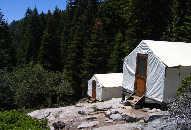
Bearpaw High Sierra Camp offers a unique opportunity to explore the High Sierra in comfort and style, a tradition in Sequoia for over 75 years. Located 11.5 miles into designated national park wilderness at an elevation of 7,800 feet, Bearpaw Camp provides unforgettable alpine memories from June to September.
Preplanning and wilderness permits:
Consider staying at Wuksachi Lodge® before and after your trip for acclimation. Wilderness permits are required but free for Bearpaw guests. If your trip includes overnight stays elsewhere, obtain a wilderness permit and pay a fee. Permits must be picked up at Lodgepole Visitor Center.
Trailhead and hike details:
The 11.5-mile hike to Bearpaw Camp begins at Crescent Meadow, approximately 10 miles south of Wuksachi Lodge. The moderate hike takes about seven hours, starting at 6,800 feet and ending at 7,800 feet, with creek crossings and scenic views.
Meals and dietary options:
Generous, home-cooked meals are served family-style, including breakfast and dinner with vegetarian options. Indulge in a variety of desserts made from scratch. Beer and wine are available for purchase.
Reservations and booking policy:
Reserve online or by phone. Cancellations may occur throughout the year, so check availability regularly for newly opened dates.
Bearpaw High Sierra Camp
Sequoia National Park, CA 93262
Reservations: (866) 807-3598
Get directions

Reservations for Bearpaw High Sierra can be made online or by phone:
Call (866) 807-3598 (international callers dial +1-801-559-4930)
Rooms
Bathrooms
General
Wilderness permits are required but free for guests staying at Bearpaw High Sierra Camp. You do not need to reserve this permit in advance; however, if your wilderness trip includes overnight stays at locations other than Bearpaw Camp, you must obtain a wilderness permit and pay a fee.
Permits can be picked up in person at the Lodgepole Visitor Center, open daily from 7 a.m. to 3:30 p.m. Permits may be obtained on the same day of your hike or the afternoon prior after 1 p.m. For additional wilderness information, visit the Sequoia & Kings Canyon National Parks website or call the wilderness office at (559) 565-3766.

